Taipei, Taiwan
THE HIDDEN PATTERNS OF THE TAMSUI RIVER


2021 - Tapei - Taiwan
Supervisor| Ministry of Culture
Presenter| Taiwan Contemporary Culture Lab
(C-LAB)
Invited Contributor, Artist Residency
Research and development initiated
by jannekederksen in support
and collab with “Who builds the city?’’
The hidden Tamsui patterns;
learning from the dike
The Taipei Basin was characterized geographically in two district river cultures; Tamshui River as commercial transport for tea, rice and camphor and the agricultural Keelung River. Where the focus of globalization-driven urbanization and the threats of floods had the lead in how we experience the relation between the river and the city, from the past to today. In 1971, channels and dikes were once identified
as the most feasible solution of protecting the Taipei Basin, where the engineering methods had won it from the natural river processes.
When most existing studies are about
the technical river in relation to the urban development of the city, this research will zoom in on the social and physical obstacles resulting from all those developments: the dike!

1) Looking forward
“Learning from the dike” studies how the dikes developed in Taipei, and how they function now, in order to speculate and formulate the future redevelopment design, questioning this safety network which should contain the discharge of 200-year floods.
“Learning from the dike” studies how the dikes developed in Taipei, and how they function now, in order to speculate and formulate the future redevelopment design, questioning this safety network which should contain the discharge of 200-year floods.
2) Time
The river used to be a friend full of resources and prosperities where settlers tended to live as close as possible to the water source. Over the years, influenced by (il)legal industrial activities and extreme weather conditions(e.g. typhoons), the river turned into an unexpected enemy where protection is necessary in order to protect the urban area. In 1971, the Flood Control Plan was drawn up, a plan where floodwalls, levees and pump stations were the sole solution to shield the urban hub. As the plan was completed, the river became sealed off from residents’ daily life.
The river used to be a friend full of resources and prosperities where settlers tended to live as close as possible to the water source. Over the years, influenced by (il)legal industrial activities and extreme weather conditions(e.g. typhoons), the river turned into an unexpected enemy where protection is necessary in order to protect the urban area. In 1971, the Flood Control Plan was drawn up, a plan where floodwalls, levees and pump stations were the sole solution to shield the urban hub. As the plan was completed, the river became sealed off from residents’ daily life.
3) Flood control plan
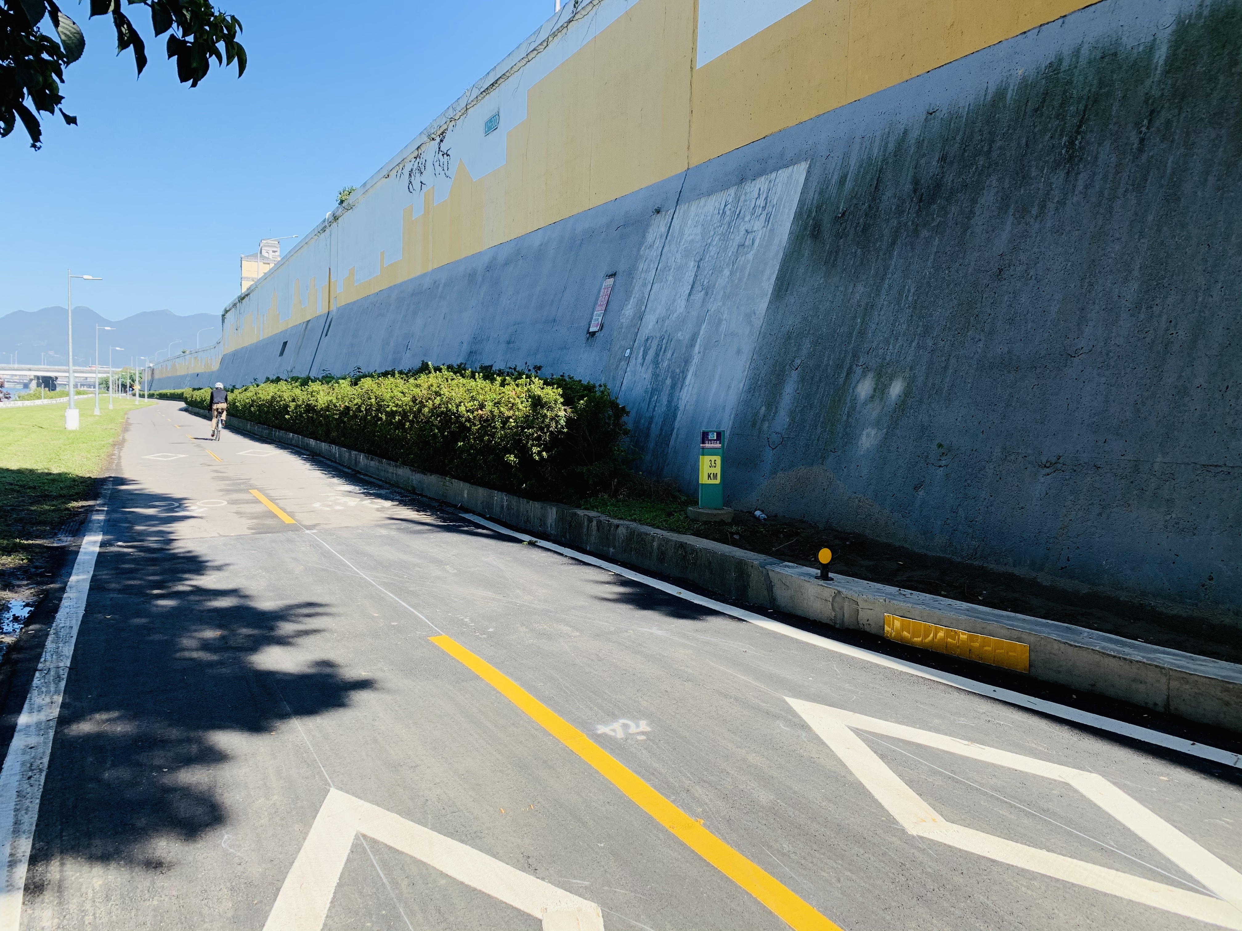
The Flood Control plan did not include ecological or social based flood control strategies for the preserves of wetlands and floodplains, for this would have impeded on land reclamation projects by the riverside. On top of the lacking aspects for the preserves, due to the limited space between the city and the river, the result therefore was the dike with protection walls of 9.68m height along most of the length of the river.
The Flood Control plan did not include ecological or social based flood control strategies for the preserves of wetlands and floodplains, for this would have impeded on land reclamation projects by the riverside. On top of the lacking aspects for the preserves, due to the limited space between the city and the river, the result therefore was the dike with protection walls of 9.68m height along most of the length of the river.
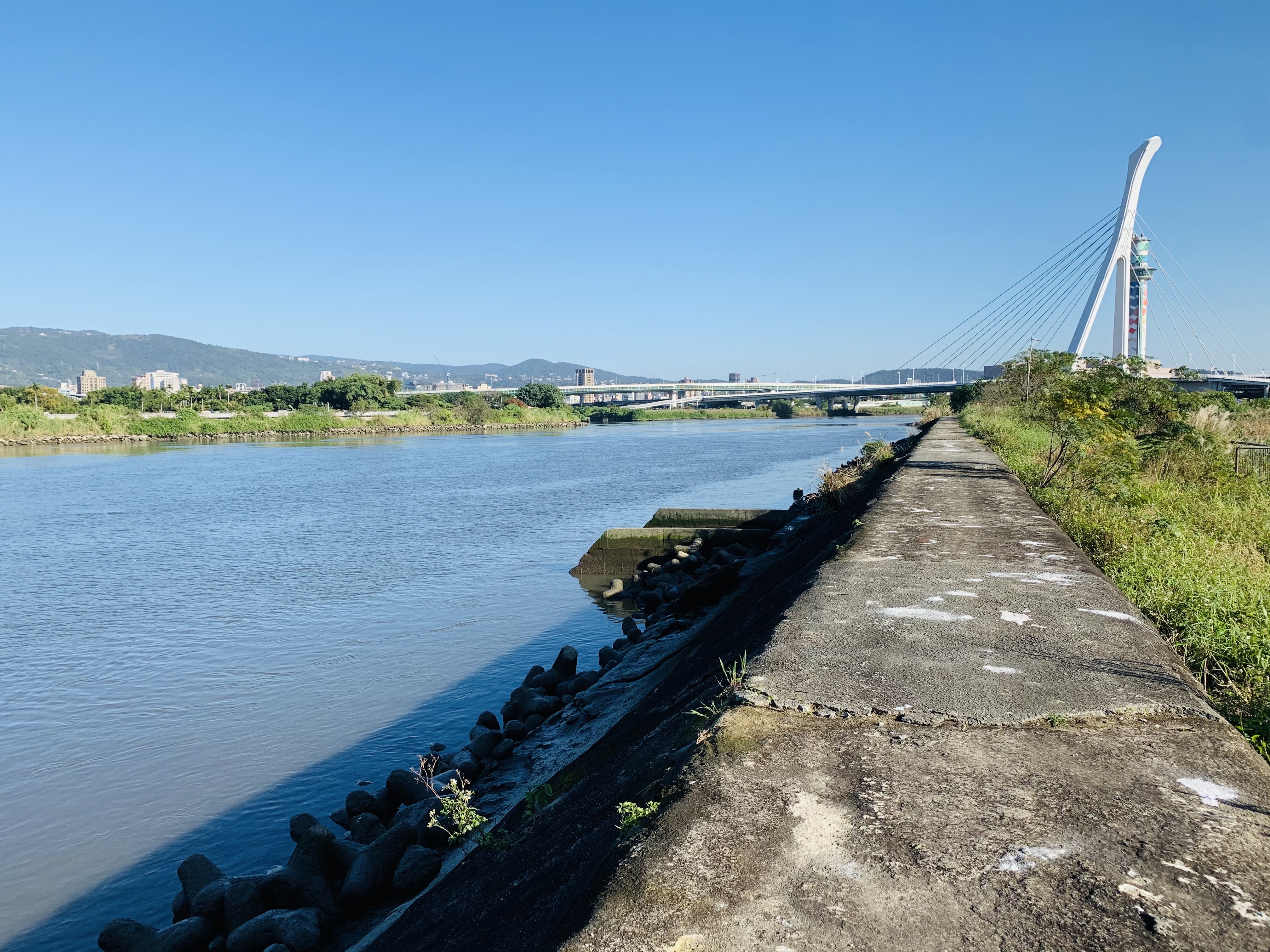
4) Unnamed public space
A new public place was formed hidden from the city and its inhabitants. These places
are democratic and inclusive, personal and anonymous at the same time; Time does not seem to exist and the city shielded by the wall does not exist, either. They are spaces without inhabitants – since the regulation forbids this.
5) Reading the dike
What does the dike look like in relation to the river and her city? What is there to be found? How have they been used in the past and how are they used today; what is the social and spatial impact over the years; are there layers of use that have been erased and if so, which? And what is the social meaning of the dike nowadays?
What does the dike look like in relation to the river and her city? What is there to be found? How have they been used in the past and how are they used today; what is the social and spatial impact over the years; are there layers of use that have been erased and if so, which? And what is the social meaning of the dike nowadays?
6)Methodology
1. Local sources: Literature research and interviews from experts and inhabitants
2. Perspective from an outsider: Field research, on-site observations, and analysis of these observations and documentation
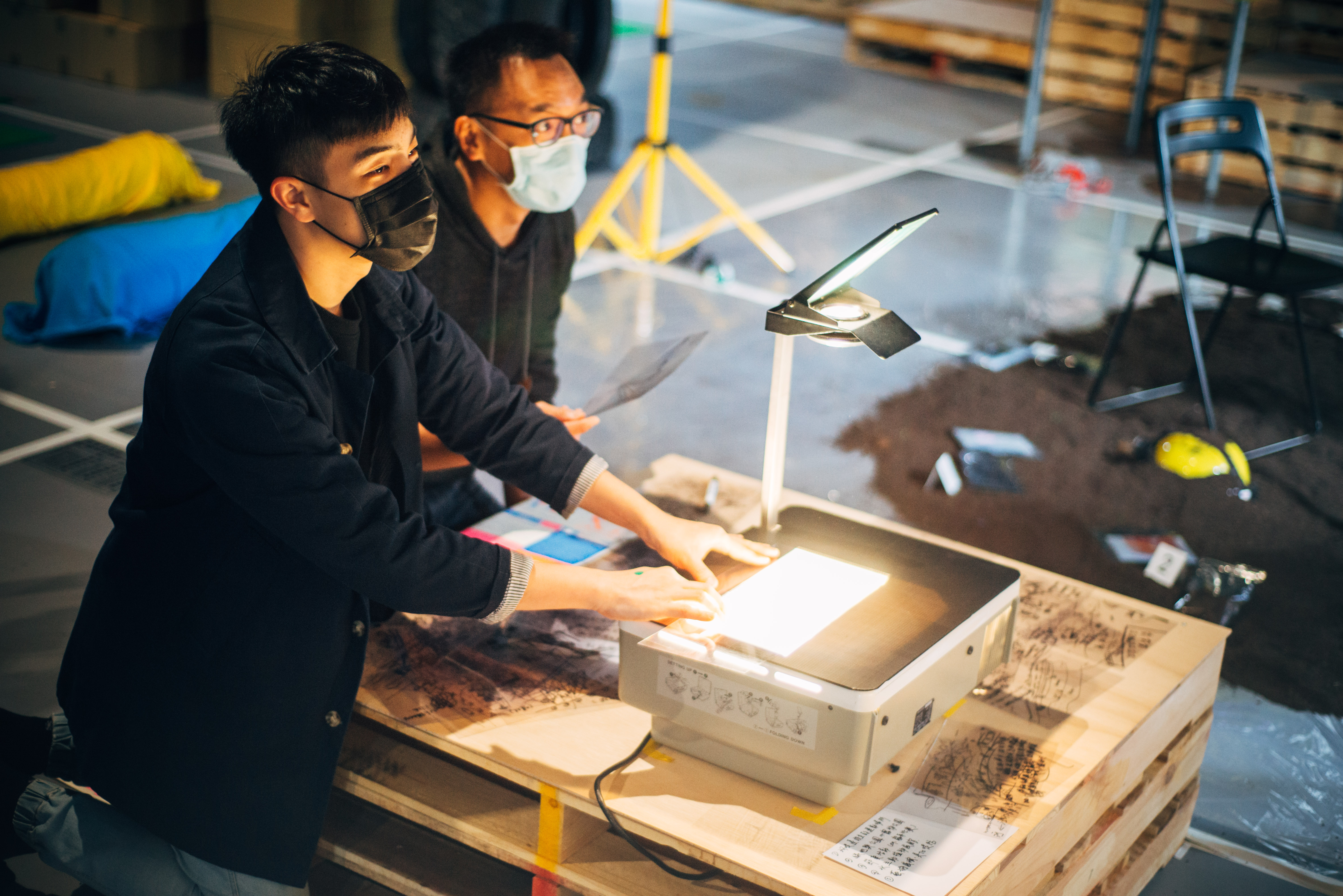
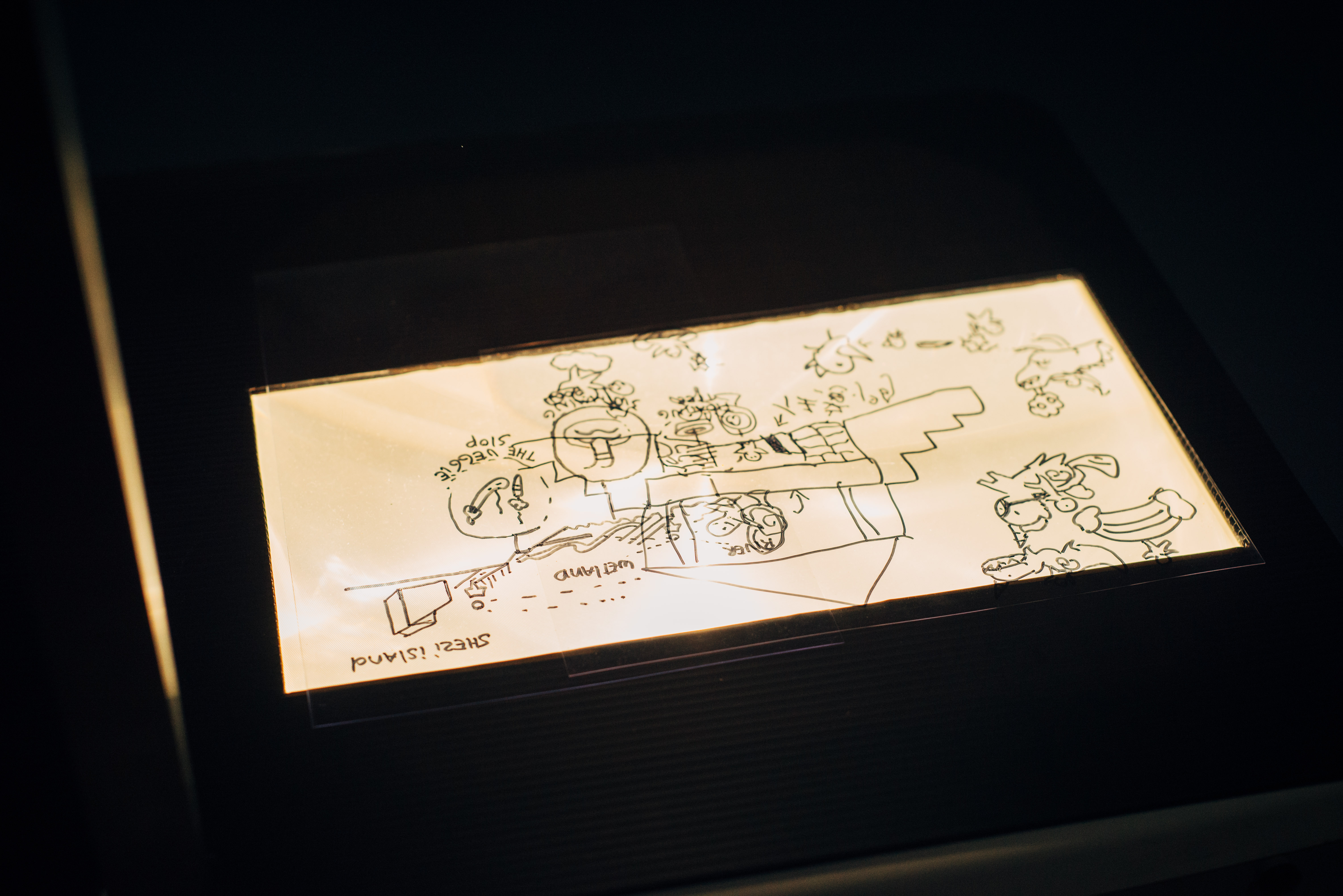
3. Narrative mapping with audio: information translating into a drawing, which includes the hidden patterns of the river and the dike of Taipei, providing participants with guidance of how to read and to experience
4. Back into the field: emergence of outsiders’ perspective with local experience
5. Documentation
1. Local sources: Literature research and interviews from experts and inhabitants
2. Perspective from an outsider: Field research, on-site observations, and analysis of these observations and documentation
3. Narrative mapping with audio: information translating into a drawing, which includes the hidden patterns of the river and the dike of Taipei, providing participants with guidance of how to read and to experience
4. Back into the field: emergence of outsiders’ perspective with local experience
5. Documentation
Learning from the river
The Hidden Patterns of the Tamsui River is a collection of research from an outsider perspective, translated into an open and accessible format.
The four audio stories explain how the dike system came into existence, which layers are erased, and the possibility to reverse the approach, and the introduction of Shezi- Island, a place which offers opportunities.
The participants are invited to guide themselves to read and to experience the hidden patterns of the river and the dike of Taipei on the journey. Then they will be asked to sketch their own proposal for the dike on Shezi Island. We use the dike as
a starting point to improve the horizontal relationship between the river and the city.

1) Why is it there?
The Taipei Basin was characterized geographically in two district river cultures; Tamshui River as commercial transport for tea, rice and camphor and the agricultural Keelung River. Where the focus of globalization-driven urbanization and the threats of floods had the lead in how we experience the relation between the river and the city, from the past until today. In 1971, canals and dikes were identified as the most feasible solution of protecting the Taipei Basin as the engineering methods intercepted the natural river flow. Since most studies are about the technical aspects from the river, in relation to the urban development of the city, this research will zoom in on the social and physical obstacles resulting from all the developments: the dike.
The Taipei Basin was characterized geographically in two district river cultures; Tamshui River as commercial transport for tea, rice and camphor and the agricultural Keelung River. Where the focus of globalization-driven urbanization and the threats of floods had the lead in how we experience the relation between the river and the city, from the past until today. In 1971, canals and dikes were identified as the most feasible solution of protecting the Taipei Basin as the engineering methods intercepted the natural river flow. Since most studies are about the technical aspects from the river, in relation to the urban development of the city, this research will zoom in on the social and physical obstacles resulting from all the developments: the dike.
2) The other way around
The Flood Control plan did not include ecological or social based flood control strategies for the preserves of wetlands and floodplains, for this would have impeded on land reclamation projects by the riverside. On top of the lacking aspects for the preserves, due to the limited space between the city and the river, the result therefore was the dike with protection walls of 9.68m height along most of the length of the river. But what if we turn it the other way round? With the new urban development we take the dike as a starting point to create new additional models for the dike, improving the horizontal interactions from the river to her city, and vice versa. Where will the hidden patterns of the river be reconnected to and, perhaps, be visible again?
3)Which layers are erased?
The river is weak, suffering from the industrial traces. Eighty years ago, the water was still clean enough for drinking and cooking; fish and shrimps were there to be found. Fishermen and sampans were seen everyday plying the river. Since the 60s, the focus for economic activity and population growth in Taipei Metropolitan has increased. The ‘people beat nature‘ mentality to protect the urbanization of flood threats, resulted in a wall of 9.68m height amongst others. Once the river was so close to the locals, now it is increasingly separated. Landowners, factory investors, and land speculators moved into the watershed to replace rural communities. Agricultural land was reformulated to meet the requirements of manufacturing and urban development. Water resources for irrigation were destroyed and the rice culture of the river disappeared.
The river is weak, suffering from the industrial traces. Eighty years ago, the water was still clean enough for drinking and cooking; fish and shrimps were there to be found. Fishermen and sampans were seen everyday plying the river. Since the 60s, the focus for economic activity and population growth in Taipei Metropolitan has increased. The ‘people beat nature‘ mentality to protect the urbanization of flood threats, resulted in a wall of 9.68m height amongst others. Once the river was so close to the locals, now it is increasingly separated. Landowners, factory investors, and land speculators moved into the watershed to replace rural communities. Agricultural land was reformulated to meet the requirements of manufacturing and urban development. Water resources for irrigation were destroyed and the rice culture of the river disappeared.
4) Shezi - Island
Shezi-island is a political backyard of
Taipei, a sandbank that has been shaped by the natural process of the river and identified back in the time as a flood plain in the downstream section of the Keelung River. The settlement of big families since the Qing Dynasty in combination with the floodplain measures over the years, have had a strong impact on the agriculture identity of the Island.
With pressure from the various local communities and the government, the urban developments of the island have been on the political agenda for more than 30 years already. How do we make sure that we do not adopt the same approach as in the past? This case study of Shezi-Island
is expected to bring in the most feasible solution of protection and development of the area with the balance between nature and social aspects.

jannekederksen 2025 — Rotterdam, The Netherlands