Taipei, Taiwan
WORKSHOP
LEARNING
FROM THE DIKE
LEARNING
FROM THE DIKE


2021 - Tapei - Taiwan
Supervisor| Ministry of Culture
Presenter| Taiwan Contemporary Culture Lab
(C-LAB)
Invited Contributor, Artist Residency
Research and development initiated
by jannekederksen in support
and collab with “Who builds the city?’’
Workshop
Learning from the dike
The workshops aim to discover the Hidden Tamsui patterns, where facts and figures are shared directly in the field to shed light on the participants’ experience on the topic and to develop a new perspective. With the starting points of questions at how the social and spatial relationship developed between the dike of the Tamsui River in Taipei, why is it there? How have they been used in the past and how are they used today? What are the ways they function and the visual language they have developed? Are there any erased layers of use? And if so, which? What does the dike look like in relation to the river and the urban hub? All the workshops are in order to speculate and formulate the design question of this safety network: the dike
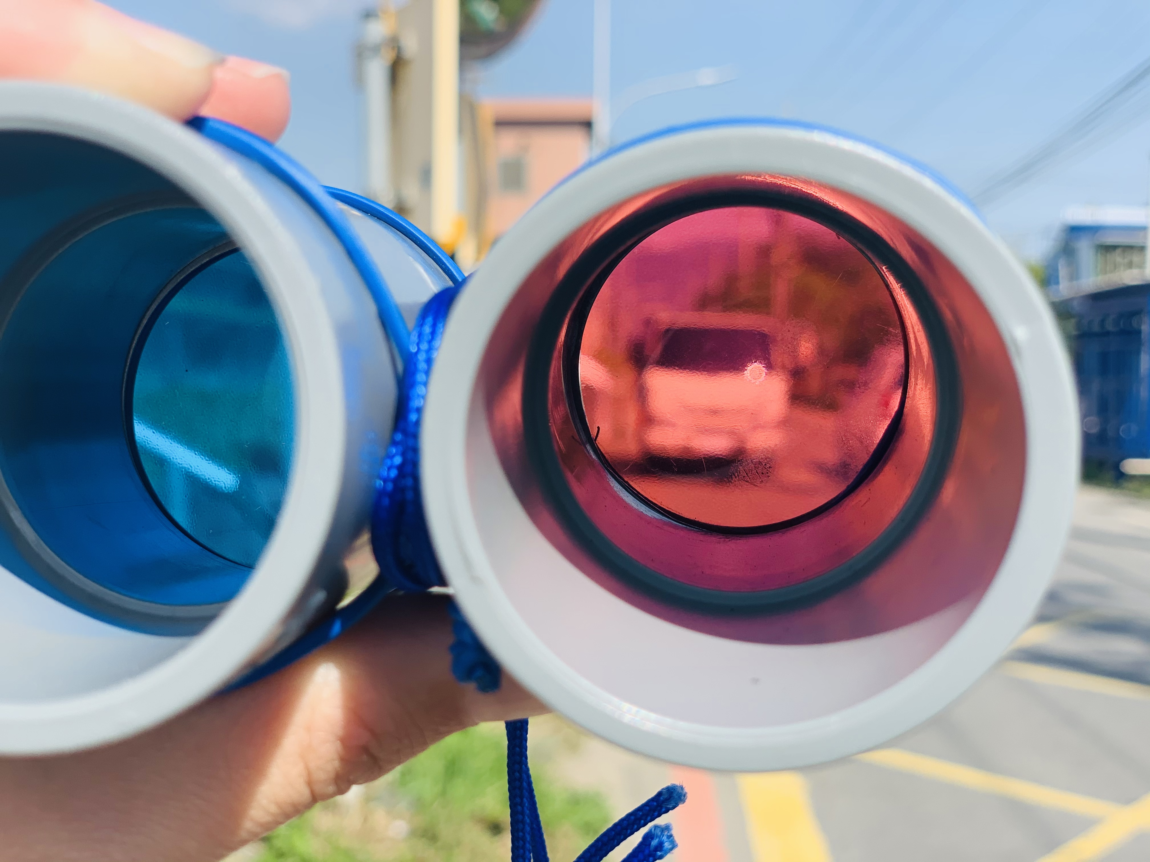
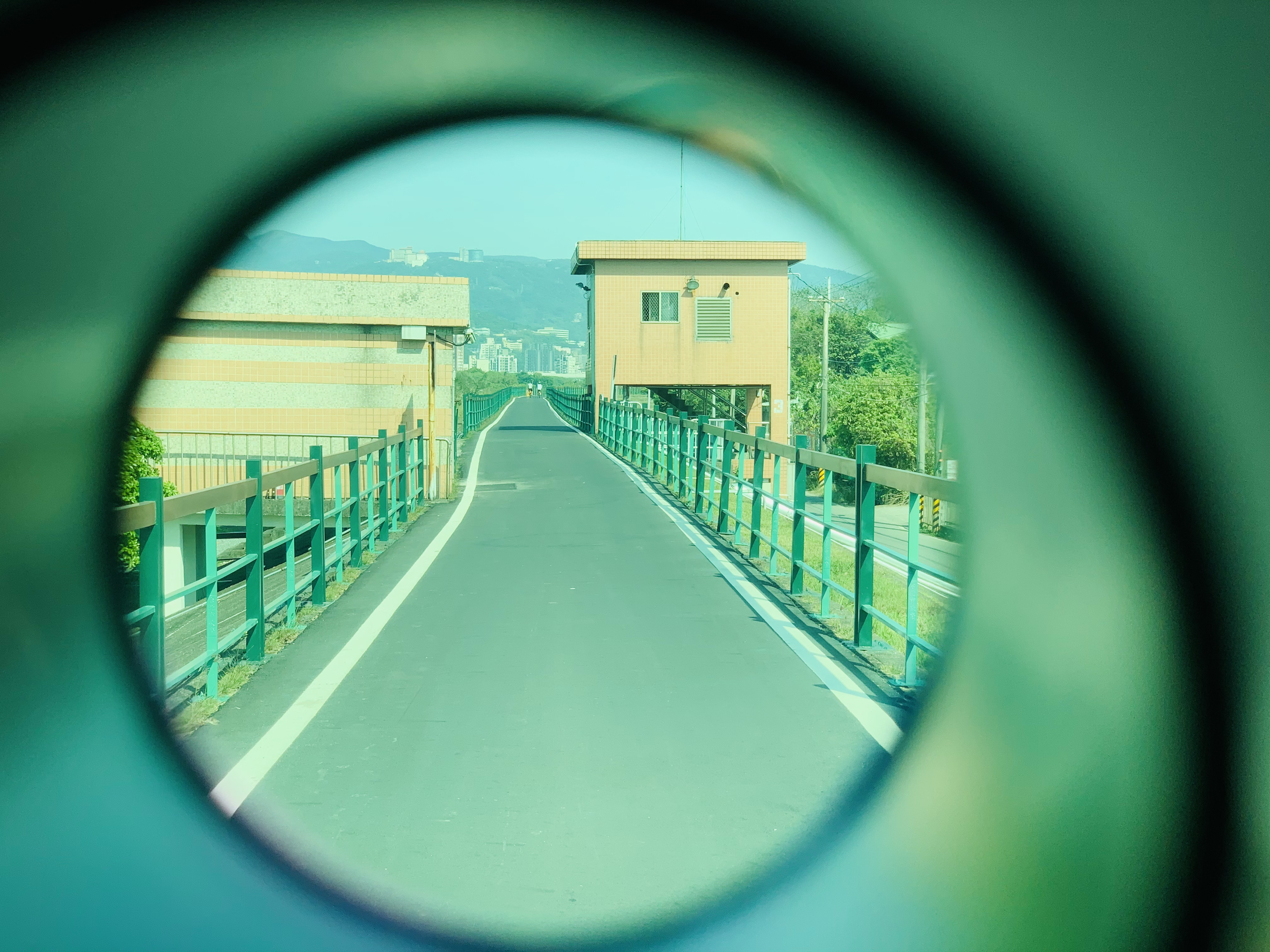

To find the answers, tools have been designed to support each individual’s observations in order to document them afterwards for analysis. The first tool, a binocular with 4-color glasses, each with its own focus. The red glasses are
for comfort and help the eyes to adjust with the contrast, increasing the depth of the field as they block the blue and green light for 100%. The yellow glasses provide a greater clarity, increasing the contrast and giving the participants a sharper view. As for the green glasses, they filter yellow and blue light off, reducing the glares and brightening the shadows. Finally, the blue color glasses improve the contours around objects and increase the color perception.
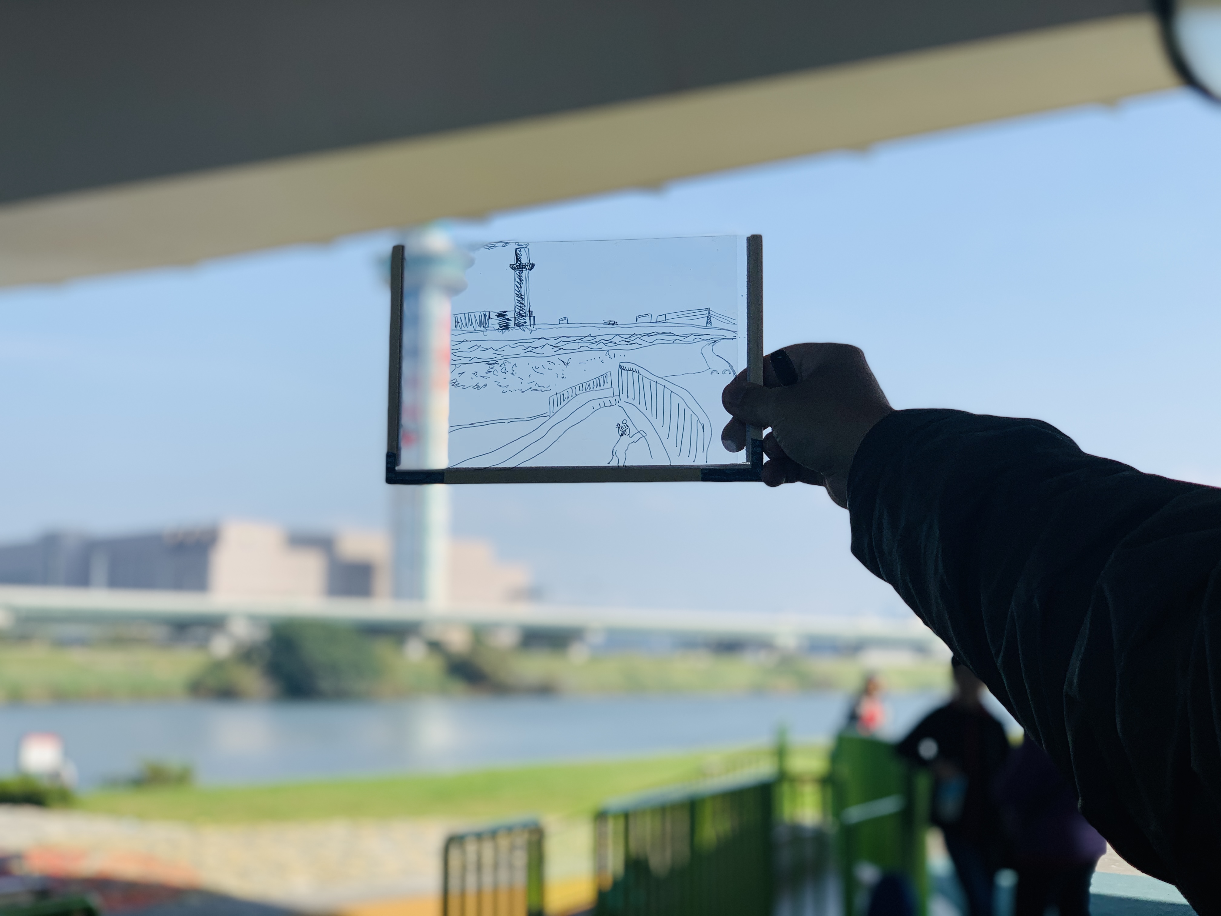
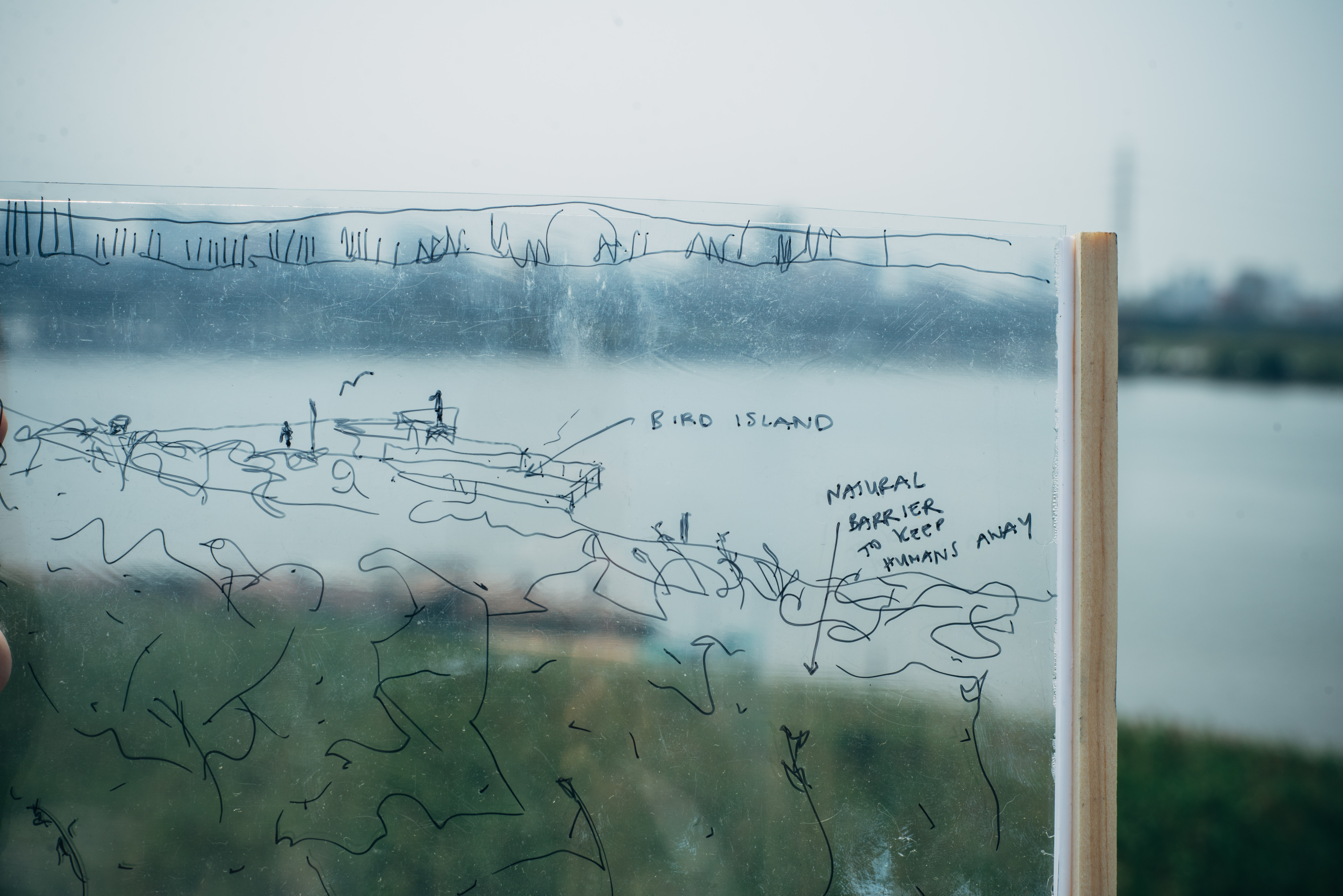
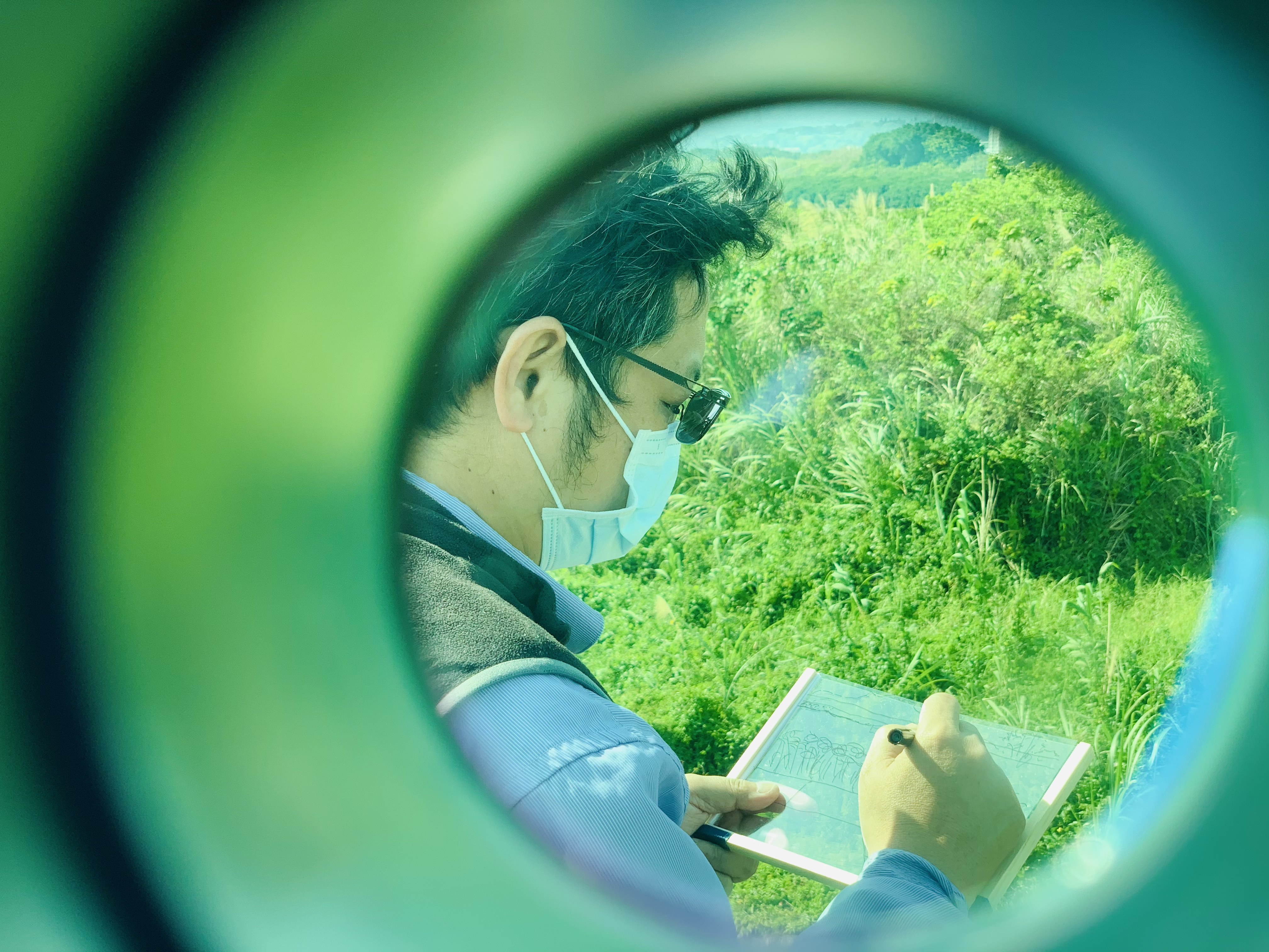
The second tool is the drawing panel to portray individuals’ observations- a transparent frame where the participants literally trace their observation in the air. Without the necessity to think about the quality of the sketching, the participants are encouraged to concentrate on what they see and simply follow the contours.
observations subjects
- sound
- objects
- material
- accessibility - activities
- users
for comfort and help the eyes to adjust with the contrast, increasing the depth of the field as they block the blue and green light for 100%. The yellow glasses provide a greater clarity, increasing the contrast and giving the participants a sharper view. As for the green glasses, they filter yellow and blue light off, reducing the glares and brightening the shadows. Finally, the blue color glasses improve the contours around objects and increase the color perception.
The second tool is the drawing panel to portray individuals’ observations- a transparent frame where the participants literally trace their observation in the air. Without the necessity to think about the quality of the sketching, the participants are encouraged to concentrate on what they see and simply follow the contours.
observations subjects
- sound
- objects
- material
- accessibility - activities
- users

Translation
The second part of the workshop aims
to translate the personal observations
into proposals which focus on the spatial and social aspects in order to create new additional models for the dike around Shezi- island. According to the flowing steps, the participants create proposals in groups.
1. Analysing and collecting
test your observations accordingto the following topics
1.1)Accessibilities at the location
1.2) Application from the profile of the dyke
1.3)The spotted users
1.4)Visual language
2. Learning and translating
2.1) What did you miss at the location?
2.2) What were the qualities?
2.3)and how to maintain them in the future?
2.4) How do you unfold the hidden layers?
3. You as a creator
3.1) Creation of conceptual ideas
3.2) Storytelling
3.3) Design based on an experience or
spatial integration


1. Looking back
What was there first? The dike or the city? Due to the limited space and integration, the conclusion is that the city was there first. Once the dikes were completed the river was directly isolated from the city and its inhabitants; from day to day, the outside dike cannot be perceived and visible from the city side. Therefore, the floodwall clearly divided the public space into the inside dike (the city) and the outside dike (riverside) which didn’t have any relation with each other.
What was there first? The dike or the city? Due to the limited space and integration, the conclusion is that the city was there first. Once the dikes were completed the river was directly isolated from the city and its inhabitants; from day to day, the outside dike cannot be perceived and visible from the city side. Therefore, the floodwall clearly divided the public space into the inside dike (the city) and the outside dike (riverside) which didn’t have any relation with each other.
2. Floodwall VS Eerth dike
In 1971, the Flood Control Plan was drawn up.
A difference in zones based on the degree of protection was established. This has resulted in 2 types of dikes: the floodwall and the earth dike. A cold concrete wall of 9.65m high was placed at the most metropolitan area of Taipei. This was seen as the only solution because the space between the river and the city was drastically minimal. On the other hand, Shezi-island, the political backyard of Taipei, a sandbank that has been shaped by the natural process of the river, was identified back in the time as a flood plain in the downstream section of the Keelung River. This led to a lower investment with a lower earth dike as protection.
3. Temprorary alternatives
Due to the possible announcement of floods, many temporary facilities in the outer dike
area have been set up. Movable self-sufficient objects such as toilets, drinks and food vending machines are examples. These are temporary objects that must be collected when a flood is announced and moved to the inside dike area. In addition to setting up temporary catering establishments, renting a place to keep karaoke and large open areas indicate that the use in the inside dike area is prepared for flooding.
The climate in Taipei requires shadowy shelters in the fight with the sunlight. Due to the limited 32
number of trees that may be allowed in the outside dike area, spaces under the bridges that connect the city with New Taipei City, offer an alternative possibility for temporary use for the public.
4. Missing Accessibilities
How close can you get to the river? All applications in the public area show examples that you can only experience the river from a distance. Or from a raised quay edge. But in reality, full access to the water is blocked.
In recent years, developments have been made in public space in the area outside the dike, following the regulations of the flood control plan. Such as viewpoints, restplaces and birdwatch houses. However, the accessible public spaces in the area inside the dike have continued to deteriorate; since the main infrastructure or access to the city is still built directly along with the wall and the dike. Therefore this has created a double obstacle for slower traffic from the city (especially for cyclists and pedestrians) to reach the area outside the dike next to the river. As a result, the dike remains as an obstacle in its own right and there is a lack of the missing link for the horizontal, social and physical interactions from the river to her city, and vice versa.
6. The other way around
The main question that has been raised now is how we get more diverse activities around or on the river when the threat from the flood is not there. What are the new possibilities within new developments? Will the result be different if we take the dike as a starting point?
In the new strategy, the first step is to look for the weakest points of the dike. The second step is to reinforce the dyke where needed while the final step is to add social interaction. The difference is that we don’t only look at the outside dike but also at the inside dike. Parallel to the last step,
the connection in the developments of urbanization will be included. In this way, the dike will no longer be an obstacle but a connecting element between the river and the city, as an accessible public space.
7. The interactive dike
The research has brought together the perspective of an outsider combined with the local experience. How does the social relationship influence the use of both the inside and outside dike at the present? And how does the new relationship turn the obstacle into a key for new opportunities?
The toolbox is a strengthening point to map out these new possibilities. The input of the participants is brought together with the expertise of the landscape designer/artist.


jannekederksen 2025 — Rotterdam, The Netherlands